Lafayette Foundation Co. takes requests from Lafayette, Acadia, St. Landry, St. Martin and Vermilion parishes and passes each to one independent local specialist. Many local specialists don't charge for the site visit; ask when they call. Ask for floor levels and a hand-augered hole, and keep the written findings regardless.
Four kinds of ground, not five parishes
Textbook prairie
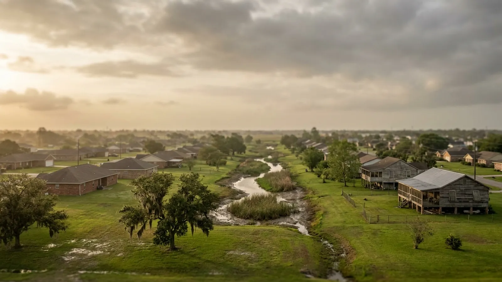
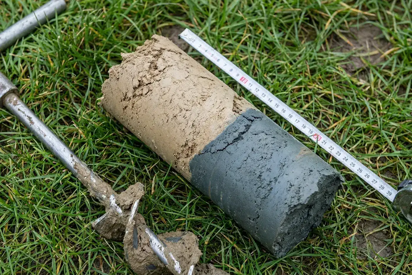
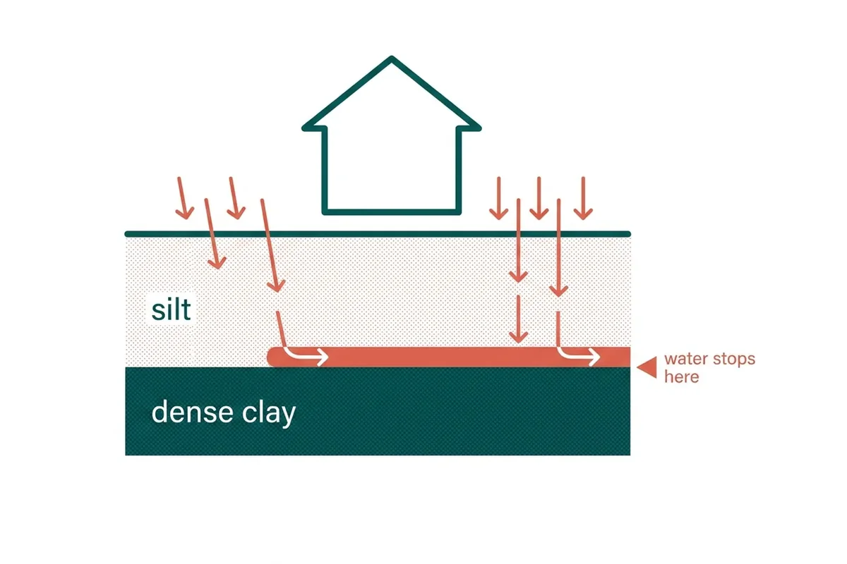
The Albaqualf profile at its most straightforward: silty top, dense clay at about fourteen inches, and no relief to shed water into. Crowley gave the soil series its name. What varies between these towns is not the ground but how easy it is to find somewhere to send the water.
Crowley · Rayne · Church Point
Prairie under development
The same profile with a great deal of new roofing and paving added on top of it. Development concentrates runoff onto ground that already cannot absorb what it gets, and the properties that notice are frequently the older ones downhill rather than the new ones.
Broussard · Youngsville · Carencro
Bayou and alluvium
Ground laid down by water rather than formed in place, which means layered and inconsistent rather than the uniform prairie profile. At Maurice the regional water table also rises, which is a different problem from perching and responds differently to a drain.
Higher ground
North into St. Landry there is genuine relief, and relief is what the rest of this region lacks. Perched water has somewhere to go, so the regional mechanism carries less of the blame and causes are more often specific to one property.
How the ground shifts across the region
| Ground | What to check first | Common finding |
|---|---|---|
| Textbook prairie | Where the water can possibly be sent | Discharge design is harder than the trench |
| Prairie under development | What was built upstream and which way it falls | Water arriving that did not use to |
| Bayou alluvium | What the auger actually finds | Layered ground; the regional profile may not apply |
| Low ground south | Whether it is perched or a high water table | Sometimes drainage has less to offer, and a good specialist says so |
| Higher ground north | What is specific to this property | A local cause, usually cheaper to fix |
The same visit everywhere
A good visit includes floor levels across the plan, a hand-augered hole, and a walk of the outside to see where water stands and where it could go. The numbers live on the cost guide, and an appointment takes a minute to arrange.
Asked about coverage
Is there an extra charge to reach Church Point or Opelousas?
Ask the specialist whether the first visit is charged and whether the drive is priced in. If a bid climbs the further out you live, that journey went into one of its lines and the bidder can point at it.
Why group towns by drainage rather than by parish?
Because drainage is the mechanism. A property on textbook prairie at Rayne and one on Teche alluvium at St. Martinville face different ground entirely, and no parish boundary marks the difference between them.
How do I know which group I am in?
The augered hole settles it in ten minutes, so ask for one during the visit. The groups describe tendencies; your own lot is the only thing that describes your lot, particularly around Carencro where the prairie starts changing.
Every town covered, and what changes there
Each of these has its own page, because the ground and the housing stock are not the same across the region. The short version:
Crowley — The town the soil is named after
Crowley silt loam is not called that by coincidence. Read what that means for a Crowley property.
Rayne — Flat, and that is the whole problem
Rayne sits on the same prairie profile with essentially no relief to work with. Read what that means for a Rayne property.
Church Point — Rural properties, longer runs
Church Point properties tend to sit on larger lots, which is helpful in one respect and expensive in another. Read what that means for a Church Point property.
Broussard — New development changes where water goes
Broussard has added a great deal of housing, roofing and paving in a short time, and all three shed water rather than absorbing it. Read what that means for a Broussard property.
Youngsville — New houses on old rice ground
Most of Youngsville's housing stock is recent, built on land that was agricultural until fairly lately. Read what that means for a Youngsville property.
Carencro — A soil boundary runs through this town
Carencro sits where the flat prairie meets the lower ground following the bayous, and that transition is not a line anybody drew. Read what that means for a Carencro property.
St. Martinville — Alluvium, not prairie
Martinville sits along the Teche, and ground deposited by a watercourse is layered quite differently from the prairie soils west of here. Read what that means for a St. Martinville property.
Maurice — Lower, wetter, and closer to the water table
Heading south from Lafayette the ground gets lower and the water table gets nearer the surface. Read what that means for a Maurice property.
Opelousas — Higher ground, and it shows
Opelousas sits north of the flat prairie on ground with more relief, and relief is exactly what the rest of this region lacks. Read what that means for an Opelousas property.
What it means when a town is covered
It means your request goes to one independent local specialist who serves the town, and many local specialists don't charge for the first visit; ask when they call. A good visit includes a laser floor survey, crack measurements and a written scope afterwards. Ask for any travel charge as its own line rather than buried inside the others, and to see that number before you agree to anything.
Foundation work is scheduled, not urgent, so a few days either way rarely changes the outcome.
These 9 communities are the ones this site covers, each with its own page on the local ground. That is the honest boundary: not a radius drawn on a map, but the places where the soil and the housing stock have been written up in enough detail to be useful.
Coverage questions
Is there an extra charge to come out to the outlying towns?
Ask for travel to be quoted as its own line when it applies, and to see it before agreeing to anything. It should not be folded into the price of the work, because a scope you cannot read is a scope you cannot compare against anyone else's.
My address is not on the list. Can I still ask?
Yes, and it is worth asking. The list is the area this site has written up, not a hard boundary. Send the address and the local specialist can say whether they cover it.
Is the first visit free?
Many local specialists don't charge for the first visit, but it depends on the company. Ask when the specialist calls, before they come out. Ask to keep the laser floor survey, the crack measurements and the written findings whether or not you go ahead, and whether or not the specialist ends up quoting the work.
Why does the price differ between towns for the same job?
Because the ground does. Each town page above explains what changes locally, and the quote follows what the visit measures at your specific address rather than an average for the region.
Book a Lafayette site visit
The single most useful thing you can tell us is what your yard does after heavy rain — whether water stands, for how long, and in which corner. On this ground that observation narrows the diagnosis further than any description of a crack. Say whether the house is raised or on a slab too. A local specialist serving Lafayette calls you back.